PRODUCTS
GPS Tracking and GIS
- Home
- Products
- GIS
- Digital Map
- 1/5,000 Taiwan Digital Map
Digital Map
1/5,000 Taiwan Digital Map
Description
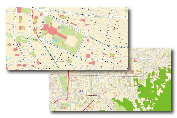
1/5,000 Taiwan Digital Map is made by the Van and referred to Aerial colored Ortho-images from Aerial Survey Office. We capture land information through cameras on the top of the Van. Besides, there are DGPS, gyroscope, and storage systems in the Van.
Layers of Polygon, Line and Point Data
- POI (Points of interest)
- Polyline:Railway, Speed High Railway, MRT(Taipei and Kaohsiung), Road Center Line, Freeway, Highway, Provincial Road, County Road, Country Road
- Polygon:Street Block, Shore, Carriageway Divider, Factory Ground, Forest, Garden Path, Grass, Green Urban Area, Paved Area, Railway Ground, Sand Area, School Ground, Swimming Pool, Walkway, Water Body
- Text:Major Road , Road, Line and River Text

